
Oeschinensee · SAC hut
Blüemlisalp Hut Hike: Oeschinensee to Hohtürli
Last updated November 2026
From Oeschinensee, mountain trails climb via Oberbärgli to the Hohtürli and the SAC Blüemlisalp hut at about 2,835 m. It's a long, steep mountain hike for experienced, well-equipped hikers in the hut season (usually from June). The Fründen hut is a harder alpine alternative.
Some booking links may earn us a commission at no extra cost to you. How this guide is funded →
The Blüemlisalp hut sits high above Oeschinensee near Hohtürli — a long mountain day for experienced hikers, not a casual shore walk.
Below are the usual approaches, times from official sources, and neighbouring hut options. Lake bowl letters: Oeschinensee hike. Wider trail menu: hikes. Check weather before you commit.
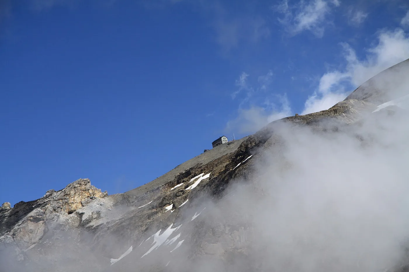
Blüemlisalphütte near Hohtürli — the high hut above Oeschinensee.
Quick facts
- Hut
- SAC Blüemlisalp ~2,835 m
- Key sections
- G ~1 h 30; H ~3 h
- Who
- Experienced mountain hikers
- Season
- Usually from June
- Winter rooms
- Bookable online, no meals
- Harder alt.
- Fründen hut via alpine I
Route sections (official times)
This is a section outline, not navigation instruction. Confirm letters and status on oeschinensee.ch the morning you go.
| Section | Letter | Time (operator) | Notes |
|---|---|---|---|
| Toward Läger / Heuberg / Oberbärgli | G | About 1 h 30 | Mountain hiking trail |
| Oberbärgli → Hohtürli | H | About 3 h | Mountain hiking trail; high alpine |
| Hohtürli → Blüemlisalp hut | — | Short final approach | Check hut page / map |
| SAC summary (with gondola) | Variant via Heuberg | About 4 h 10 | Hut arrival page |
Mountain hiking trail G Läger–Heuberg–Oberbärgli is listed at about 1 h 30; mountain hiking trail H Oberbärgli–Hohtürli at about 3 hours.
The SAC Blüemlisalp hut arrival page lists about 4 h 10 hiking time using the Oeschinensee cable car on the Heuberg / Oberbärgli / Hohtürli variant, or about 5 h 30 from Kandersteg without counting on a faster mix.
From the shore, many parties also use lake-side mountain links (for example toward Underbärgli / Oberbärgli) before committing to H — confirm the combination on the official interactive map. Do not invent a single blog “clockwork” that ignores closures.
Official listings place the SAC Blüemlisalp hut at about 2,835 m (the SAC hut site also rounds near 2,840 m — treat both as the same high hut, not two different buildings).
Who it is for
This is a long, steep mountain hike for experienced, well-equipped walkers with sure footing, weather judgement and honest fitness. It is not trail C with a longer lunch.
Swiss trail categories matter: white-red-white mountain hiking marks are not the same commitment as yellow hiking paths or white-blue-white alpine routes. Read the SAC hiking scale overview before you upgrade ambition. We describe grades; we do not teach technique, rope work or “how to cross snowfields.”
If you are unsure after reading the operator’s mountain-trail warnings, stay on Oeschinensee hike letters C/D or hire a certified mountain guide.
Season and hut nights
SAC Blüemlisalp hut summer season is described as opening in June; winter quarters can be reserved online without meals.
Exact opening and closing dates move with snow — the live status page may show the next calendar year’s June start when you check in late autumn. The SAC arrival page also describes a mid-June to mid-October style summer window depending on winter onset. Always re-check before you reserve trains and beds.
Hut nights: book through the SAC hut reservation system. Winter rooms are a different product (no meals). Do not count on walk-in space after a late Hohtürli arrival on a bluebird Saturday.
The Fründen hut alternative
SAC Fründen hut sits at about 2,562 m; alpine trail I Underbärgli–Fründenhütte opens around June.
The wandern page describes the Fründen approach via Underbärgli / lower Fründschnuer as an alpine hike for experienced, ambitious mountain hikers — sure-footed, head for heights, with via ferrata set context on the operator text.
Treat Fründen as a harder alpine alternative, not a casual swap for Blüemlisalp when weather turns. Confirm open/closed status separately from G/H.
The Doldenhorn hut
If you want a high overnight without the Hohtürli day:
SAC Doldenhorn hut at about 1,915 m typically opens from mid-May; winter rooms by phone without meals; trail J from Kandersteg via the Waldhotel is about 2 h 20 and challenging.
That keeps you on the Kandersteg side with a shorter approach than Blüemlisalp, still as a mountain day. Lakeside hotel context remains on hotels at the lake.
Before and after: a night in Kandersteg
A hut approach works better when you sleep in the valley the night before: early gondola (summer slot), full daylight buffer, and a soft landing if weather kills the high plan. Compare where to stay and lake-adjacent options on hotels at the lake.
After a traverse into Kiental, you may finish away from your suitcase — plan luggage and trains before you celebrate the pass selfie. Another night back in Kandersteg via where to stay beats improvising with a heavy pack on a late connection.
Status before you go
Pair that with weather and the SAC hut booking tool. Rockfall restricted zones at the lake still apply on approach days — barriers are not optional scenery.
Continuing toward Kiental
The SAC hut sits between Kandersteg and Kiental; the arrival page describes a Griesalp–Bundalp–Hohtürli approach of about 4 h 30 and tips descent toward Bundalp–Griesalp with a map.geo.admin.ch reference.
That answers “can I continue to Kiental?” — yes as a planned traverse or second day, not as an impulse add-on after a late Oeschinensee start. Via Alpina storytelling also uses the Hohtürli corridor on neighbouring stages; treat those as separate long-distance products from this hut day.
How this fits the hike list
Blüemlisalp is the hard card on hikes after you already understand Oeschinensee hike letters. Soft alternatives the same week: Gemmi, Gasterntal or trail C. Keep weather and where to stay in the tab bar — the hut rewards preparation more than ambition theatre.
Your questions, answered
How long is the hike to the Blüemlisalp hut?
Operator sections sum to a long mountain day — roughly 1 h 30 on G (Läger–Heuberg–Oberbärgli) plus about 3 h on H (Oberbärgli–Hohtürli), before the final approach to the hut. The SAC hut page lists about 4 h 10 with the Oeschinensee cable car on the Heuberg / Oberbärgli variant. Check live times and your pace.
Is it dangerous?
It is a steep mountain hike with exposure, weather and rockfall risk — not a lakeside stroll. We do not call any route “safe.” If you are unsure about mountain-trail terrain, choose lower letters or hire a certified guide.
When is the hut open?
The summer season is usually from June (exact dates change yearly). Winter quarters without meals can often be booked online — confirm on the hut booking system.
Can I sleep at the hut?
Yes in the summer season when beds are available, and as winter quarters without meals when that product is offered. Reserve through the SAC hut reservation system; do not assume walk-in space on peak weekends.
Can I continue to Kiental?
Yes. The SAC Blüemlisalp hut sits between the Kandersteg and Kiental sides; the hut arrival page describes approaches from Griesalp / Bundalp and tips for descending toward Bundalp–Griesalp. Plan as a traverse or overnight, not a casual add-on after a late start.